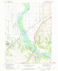
1968 Map of Ashland East
USGS Topo · Published 1970About this map
The Platte River corridor serves as the primary geographical and industrial artery for this region of eastern Nebraska in the late 1960s. At the confluence where Wahoo Creek and Salt Creek join the Platte, the community of Ashland sits as a central hub, flanked by extensive sand and gravel operations. The presence of numerous quarries along the riverbanks, particularly near South Bend, highlights the local importance of aggregate mining during this era.
Find a feature on this map
35 named features on this map. Tap any name to fly to it.
Don’t see what you’re looking for? This feature index may not catch every label — zoom into the map to look around manually.
Map Details
Editions of this 1968 Ashland East Map
4 editions found
Other maps of this area

1893 · Fremont
USGS Topo · 1:125,000

1896 · Fremont
USGS Topo · 1:125,000

1903 · Weeping Water
USGS Topo · 1:125,000

1929 · Weeping Water
USGS Topo · 1:125,000

1955 · Fremont
USGS Topo · 1:250,000

1955 · Lincoln
USGS Topo · 1:250,000

1956 · Gretna
USGS Topo · 1:24,000

1956 · Springfield
USGS Topo · 1:24,000

1957 · Fremont
USGS Topo · 1:250,000

1957 · Lincoln
USGS Topo · 1:250,000