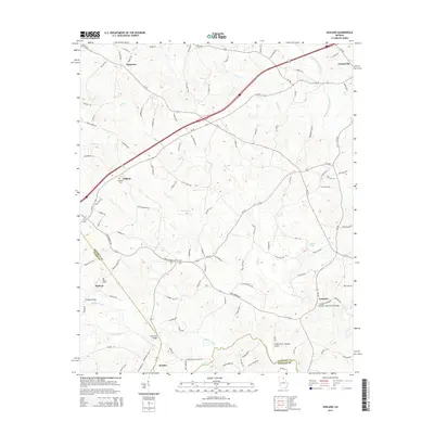
2014 Map of Ashland
USGS Topo · Published 2014About this map
The Middle Fork Broad River and Hudson River define the agricultural landscape of Franklin County on this 2014 survey. This portion of northeast Georgia is characterized by a network of small, scattered communities like Ashland, Hebron, and Erastus, connected by a web of state routes including Ga-59 and Ga-51. The map reveals the historical and social centerpieces of these rural areas, such as the Ebenezer Cem and Hebron Cem.
Find a feature on this map
120 named features on this map. Tap any name to fly to it.
Don’t see what you’re looking for? This feature index may not catch every label — zoom into the map to look around manually.
Map Details
Editions of this 2014 Ashland Map
This is the sole edition of this map. No revisions or reprints were ever made.
Other maps of this area

1891 · Carnesville
USGS Topo · 1:125,000

1954 · Greenville
USGS Topo · 1:250,000

1958 · Greenville
USGS Topo · 1:250,000

1958 · Danielsville
USGS Topo · 1:62,500

1959 · Carnesville
USGS Topo · 1:24,000

1960 · Martin
USGS Topo · 1:24,000

1964 · Commerce
USGS Topo · 1:24,000

1964 · Ila
USGS Topo · 1:24,000

1964 · Ashland
USGS Topo · 1:24,000
1964 · Lake Russell
USGS Topo · 1:24,000