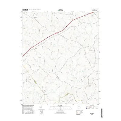
2017 Map of Ashland
USGS Topo · Published 2017About this map
Ashland and the surrounding rural communities of Hebron and Erastus define this landscape where the Hudson River meets the tributary waters of Nails Creek and Crockett Cr. The map documents a territory defined by historical river crossings and agricultural settlements at the intersection of Franklin and Madison counties. A significant highlight is the Cromers Mill Covered Bridge, a preserved piece of local infrastructure situated near the community of Cromers.
Find a feature on this map
116 named features on this map. Tap any name to fly to it.
Don’t see what you’re looking for? This feature index may not catch every label — zoom into the map to look around manually.
Map Details
Editions of this 2017 Ashland Map
This is the sole edition of this map. No revisions or reprints were ever made.
Other maps of this area

1891 · Carnesville
USGS Topo · 1:125,000

1954 · Greenville
USGS Topo · 1:250,000

1958 · Greenville
USGS Topo · 1:250,000

1958 · Danielsville
USGS Topo · 1:62,500

1959 · Carnesville
USGS Topo · 1:24,000

1960 · Martin
USGS Topo · 1:24,000

1964 · Commerce
USGS Topo · 1:24,000

1964 · Ila
USGS Topo · 1:24,000

1964 · Ashland
USGS Topo · 1:24,000
1964 · Lake Russell
USGS Topo · 1:24,000