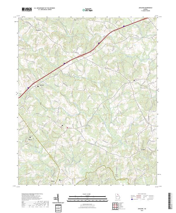
2024 Map of Ashland
USGS Topo · Published 2024About this map
Ashland and the surrounding rural landscape of Franklin County are defined by a network of creeks and the meandering Hudson River. This modern survey illustrates a region where small communities like Hebron and Erastus persist alongside historic transit routes such as the Old Federal Rd. The terrain is marked by significant local genealogy sites, including several burial grounds like Ebenezer Cem and Bold Springs Cem that serve as anchors for these long-standing settlements. In the southern portion of the quadrangle, the convergence of Franklin Co with Banks and Madison counties occurs near Hudson River Landing. The geography shows a transition from the upland reaches of Indian Creek and Nails Creek toward the broader drainage of the Middle Fork Broad River, documenting the persistent agricultural and residential patterns of this part of Georgia.
Find a feature on this map
120 named features on this map. Tap any name to fly to it.
Don’t see what you’re looking for? This feature index may not catch every label — zoom into the map to look around manually.
Map Details
Editions of this 2024 Ashland Map
This is the sole edition of this map. No revisions or reprints were ever made.
Other maps of this area

1891 · Carnesville
USGS Topo · 1:125,000

1954 · Greenville
USGS Topo · 1:250,000

1958 · Greenville
USGS Topo · 1:250,000

1958 · Danielsville
USGS Topo · 1:62,500

1959 · Carnesville
USGS Topo · 1:24,000

1960 · Martin
USGS Topo · 1:24,000

1964 · Commerce
USGS Topo · 1:24,000

1964 · Ila
USGS Topo · 1:24,000

1964 · Ashland
USGS Topo · 1:24,000
1964 · Lake Russell
USGS Topo · 1:24,000