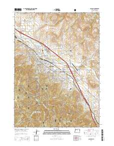
2014 Map of Ashland
USGS Topo · Published 2014About this map
Ashland is the focal point of this Jackson County survey, showcasing the city's complex interface with the steep terrain of the Rogue River National Forest. The map documents the educational and civic infrastructure of the era, including the Southern Oregon University campus and several historic burial grounds such as the Independent Order of Odd Fellows Cemetery and Mountain View Cemetery. The transportation corridor is defined by the Southern Pacific railroad and major arteries like Siskiyou Boulevard, which parallel the course of Bear Creek. To the south and west, the landscape rises sharply into the mountains, where water management features like Reeder Reservoir and various irrigation canals, such as the Ashland Lateral, are vital to the valley's settlement. Notable landmarks like the Ashland Municipal Airport and Pompadour Bluff provide distinct geographic anchors for the region.
Find a feature on this map
104 named features on this map. Tap any name to fly to it.
Don’t see what you’re looking for? This feature index may not catch every label — zoom into the map to look around manually.
Map Details
Editions of this 2014 Ashland Map
This is the sole edition of this map. No revisions or reprints were ever made.
Other maps of this area

1891 · Ashland
USGS Topo · 1:250,000

1893 · Ashland
USGS Topo · 1:250,000

1897 · Ashland
USGS Topo · 1:250,000

1938 · Medford
USGS Topo · 1:125,000

1954 · Medford
USGS Topo · 1:62,500

1954 · Lakecreek
USGS Topo · 1:62,500

1954 · Talent
USGS Topo · 1:62,500

1954 · Ashland
USGS Topo · 1:62,500

1955 · Medford
USGS Topo · 1:250,000

1957 · Medford
USGS Topo · 1:250,000