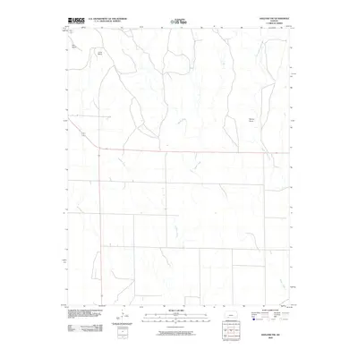
2009 Map of Ashland NW
USGS Topo · Published 2009About this map
Big Basin and Little Basin define the northern portion of this high plains landscape, representing distinctive geological sinkholes that break the flat horizon of Clark County. These natural depressions, coupled with topographic landmarks like Beckys Knob, provided essential navigational waypoints for early travelers and cattle drivers across the shortgrass prairie. The drainage pattern here is governed by several winding waterways, including Antelope Creek and Keiger Creek, which cut subtle valleys through the sectioned ranch land. While the area remains predominantly open and rural, the map details the network of section lines and secondary roads that connect the isolated water sources of Little Sandy Creek to the broader regional transportation grid.
Find a feature on this map
6 named features on this map. Tap any name to fly to it.
Don’t see what you’re looking for? This feature index may not catch every label — zoom into the map to look around manually.
Map Details
Editions of this 2009 Ashland NW Map
This is the sole edition of this map. No revisions or reprints were ever made.
Other maps of this area

1892 · Meade
USGS Topo · 1:125,000

1896 · Ashland
USGS Topo · 1:125,000

1955 · Pratt
USGS Topo · 1:250,000

1955 · Dodge City
USGS Topo · 1:250,000

1958 · Dodge City
USGS Topo · 1:250,000

1959 · Pratt
USGS Topo · 1:250,000

1959 · Dodge City
USGS Topo · 1:250,000

1967 · Fowler SE
USGS Topo · 1:24,000

1972 · Ashland NW
USGS Topo · 1:24,000
1972 · Proffitt Lake
USGS Topo · 1:24,000