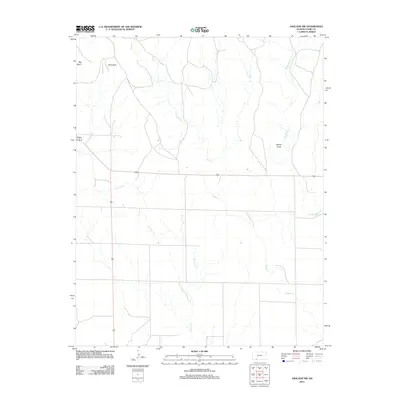
2012 Map of Ashland NW
USGS Topo · Published 2012About this map
Big Basin and Little Basin dominate the northwestern corner of this Kansas landscape, marking a distinctive geological depression in the High Plains. The terrain is defined by the winding paths of Keiger Cr, Antelope Cr, and Little Sandy Cr, which drain the open ranchland of Clark County. In the eastern portion of the quadrangle, Beckys Knob rises as a prominent landmark above the surrounding prairie. This 2012 survey captures the modern road network where U.S. Routes 160 and 283 converge before Route 160 strikes east across the plains. The map reflects the sparse, open character of this cattle-ranching region, emphasizing the drainage patterns and physical topography that have dictated land use in southwest Kansas for generations.
Find a feature on this map
9 named features on this map. Tap any name to fly to it.
Don’t see what you’re looking for? This feature index may not catch every label — zoom into the map to look around manually.
Map Details
Editions of this 2012 Ashland NW Map
This is the sole edition of this map. No revisions or reprints were ever made.
Other maps of this area

1892 · Meade
USGS Topo · 1:125,000

1896 · Ashland
USGS Topo · 1:125,000

1955 · Pratt
USGS Topo · 1:250,000

1955 · Dodge City
USGS Topo · 1:250,000

1958 · Dodge City
USGS Topo · 1:250,000

1959 · Pratt
USGS Topo · 1:250,000

1959 · Dodge City
USGS Topo · 1:250,000

1967 · Fowler SE
USGS Topo · 1:24,000

1972 · Ashland NW
USGS Topo · 1:24,000
1972 · Proffitt Lake
USGS Topo · 1:24,000