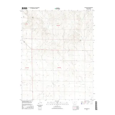
2016 Map of Ashland NW
USGS Topo · Published 2016About this map
Big Basin and Little Basin dominate the northwestern landscape of this corner of Clark County, illustrating the unique geological sinkholes found in the High Plains. This prairie terrain is defined by a dendritic network of seasonal drainages, including the headwaters of Antelope Cr, Keiger Cr, and Little Sandy Cr. The geography is largely segmented by the Public Land Survey System, with township boundaries like t32s r24w and t33s r25w framing the sparsely populated ranching and agricultural land.
Find a feature on this map
26 named features on this map. Tap any name to fly to it.
Don’t see what you’re looking for? This feature index may not catch every label — zoom into the map to look around manually.
Map Details
Editions of this 2016 Ashland NW Map
This is the sole edition of this map. No revisions or reprints were ever made.
Other maps of this area

1892 · Meade
USGS Topo · 1:125,000

1896 · Ashland
USGS Topo · 1:125,000

1955 · Pratt
USGS Topo · 1:250,000

1955 · Dodge City
USGS Topo · 1:250,000

1958 · Dodge City
USGS Topo · 1:250,000

1959 · Pratt
USGS Topo · 1:250,000

1959 · Dodge City
USGS Topo · 1:250,000

1967 · Fowler SE
USGS Topo · 1:24,000

1972 · Ashland NW
USGS Topo · 1:24,000
1972 · Proffitt Lake
USGS Topo · 1:24,000