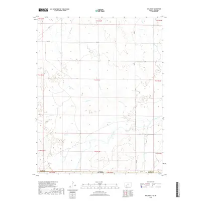
2018 Map of Ashland SE
USGS Topo · Published 2018About this map
The Cimarron River carves a broad valley across this 2018 survey of the Kansas and Oklahoma border, where Clark County and Harper County meet. The landscape is defined by a dense network of intermittent drainages, including the prominent Big Sandy Cr and Little Sandy Cr, which feed into the main river channel. This section of the High Plains illustrates a sparse, grid-based rural infrastructure where unpaved routes like Acres Rd, River Rd, and Angle Rd provide the only access across the varying elevation. The drainage patterns of smaller tributaries such as Bullard Cr, Stink Cr, and Keiger Cr reveal the intricate erosion of the prairie, creating a topography that influenced the placement of early ranching and agricultural boundaries along the Kansas-Oklahoma state line.
Find a feature on this map
34 named features on this map. Tap any name to fly to it.
Don’t see what you’re looking for? This feature index may not catch every label — zoom into the map to look around manually.
Map Details
Editions of this 2018 Ashland SE Map
This is the sole edition of this map. No revisions or reprints were ever made.
Other maps of this area

1894 · Sitka
USGS Topo · 1:62,500

1896 · Ashland
USGS Topo · 1:125,000

1955 · Woodward
USGS Topo · 1:250,000

1955 · Pratt
USGS Topo · 1:250,000

1958 · Woodward
USGS Topo · 1:250,000

1959 · Pratt
USGS Topo · 1:250,000

1970 · Buffalo NW
USGS Topo · 1:24,000
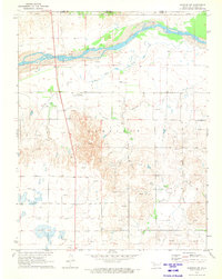
1970 · Rosston NW
USGS Topo · 1:24,000

1970 · Rosston NE
USGS Topo · 1:24,000

1972 · Ashland NW
USGS Topo · 1:24,000