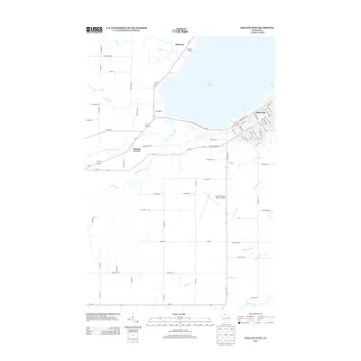
2013 Map of Ashland West
USGS Topo · Published 2013About this map
Lake Superior dominates the northern horizon of this coastal Wisconsin region, where the urban grid of Ashland meets the agricultural and marshy lowlands of the Chequamegon Bay area. The landscape is defined by a dense network of watercourses, including the meandering Fish Creek, Whittlesey Creek, and the White River, which carve through the terrain south of the shoreline. Historically significant transit points like Ashland Junction and the small settlement of Barksdale mark the convergence of regional routes such as Us-2 and Wi-13. The southern portion of the map transitions into a more rural layout, characterized by family-named roads like Johnson Road and Heglund Road surrounding the John F Kennedy Memorial Airport. This map illustrates the balance between the industrial port city's reach and the persistent hydrological features that shape the Lake Superior south shore.
Find a feature on this map
85 named features on this map. Tap any name to fly to it.
Don’t see what you’re looking for? This feature index may not catch every label — zoom into the map to look around manually.
Map Details
Editions of this 2013 Ashland West Map
This is the sole edition of this map. No revisions or reprints were ever made.
Other maps of this area

1942 · Ashland
USGS Topo · 1:48,000

1942 · Marengo
USGS Topo · 1:48,000

1944 · Moquah
USGS Topo · 1:48,000

1944 · Grandview
USGS Topo · 1:48,000

1945 · Marengo
USGS Topo · 1:48,000

1947 · Moquah
USGS Topo · 1:48,000

1947 · Ashland
USGS Topo · 1:48,000

1947 · Grandview
USGS Topo · 1:48,000

1953 · Ashland
USGS Topo · 1:250,000

1958 · Ashland
USGS Topo · 1:250,000