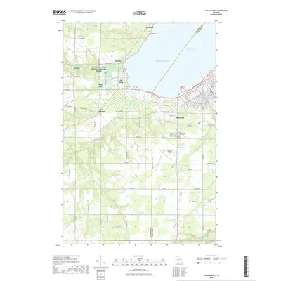
2018 Map of Ashland West
USGS Topo · Published 2018About this map
Ashland sits at the southwestern curve of Chequamegon Bay, where the urban grid meets the sprawling wetlands and forests of the Lake Superior shore. This 2018 survey detail shows a landscape defined by its proximity to Lake Superior, with numerous drainage systems like Fish Creek, Bay City Cr, and Little Beartrap Cr moving through the terrain. The presence of the Whittlesey Creek National Wildlife Refuge and the Tri Co Corridor indicates a modern focus on conservation and recreation atop an older industrial foundation. Genealogy and local history researchers will find several notable burial grounds located south of the main settlement, including Mount Hope Cem, Saint Agnes Cem, and B'Nai Israel Cem. The map also documents transportation infrastructure ranging from the John F Kennedy Memorial Airport to the Ashland Junction area.
Find a feature on this map
108 named features on this map. Tap any name to fly to it.
Don’t see what you’re looking for? This feature index may not catch every label — zoom into the map to look around manually.
Map Details
Editions of this 2018 Ashland West Map
This is the sole edition of this map. No revisions or reprints were ever made.
Other maps of this area

1942 · Ashland
USGS Topo · 1:48,000

1942 · Marengo
USGS Topo · 1:48,000

1944 · Moquah
USGS Topo · 1:48,000

1944 · Grandview
USGS Topo · 1:48,000

1945 · Marengo
USGS Topo · 1:48,000

1947 · Moquah
USGS Topo · 1:48,000

1947 · Ashland
USGS Topo · 1:48,000

1947 · Grandview
USGS Topo · 1:48,000

1953 · Ashland
USGS Topo · 1:250,000

1958 · Ashland
USGS Topo · 1:250,000