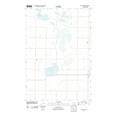
2011 Map of Ashley West
USGS Topo · Published 2011About this map
The rolling glacial terrain of McIntosh County is defined by its significant water bodies and the quiet history of its rural landscape. Lake Hoskins serves as a central landmark in the southern half of the quadrangle, managed by the Lake Hoskins Dam. To the north, the terrain transitions into the seasonal basins of Goose Lake and the expansive, often marshy Dry Lake, illustrating the fluctuating hydrology of the North Dakota prairie. For those tracing family roots in this corner of the state, the presence of the Beth Itzchock Cemetery and the Hoskins Community Cemetery provides specific geographic markers of the early settlement era. The map’s grid of gravel roads, including 45th Ave SE and 93rd St SE, outlines a region where the vast majority of the land remains dedicated to agriculture and the preservation of open prairie wetlands.
Find a feature on this map
23 named features on this map. Tap any name to fly to it.
Don’t see what you’re looking for? This feature index may not catch every label — zoom into the map to look around manually.
Map Details
Editions of this 2011 Ashley West Map
This is the sole edition of this map. No revisions or reprints were ever made.
Other maps of this area

1953 · Jamestown
USGS Topo · 1:250,000

1954 · Aberdeen
USGS Topo · 1:250,000

1956 · Aberdeen
USGS Topo · 1:250,000

1956 · Jamestown
USGS Topo · 1:250,000

1978 · Wolff Lake
USGS Topo · 1:24,000

1978 · Venturia
USGS Topo · 1:24,000

1978 · Schumacher Lake NE
USGS Topo · 1:24,000

1982 · Danzig
USGS Topo · 1:24,000

1982 · Ashley East
USGS Topo · 1:24,000

1982 · May Lake
USGS Topo · 1:24,000