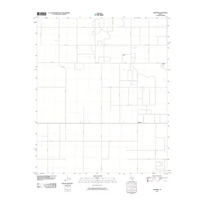
2010 Map of Ashmore
USGS Topo · Published 2010About this map
The settlement of Ashmore and the industrial activity of the Adair Oil Field characterize this portion of the Texas South Plains in the early 21st century. The map reveals a highly structured landscape defined by a relentless grid of section lines and county roads, such as Co Rd 690 and Co Rd 139, which facilitate both agricultural transport and energy extraction. In the northeastern corner, the small community of Adair sits near the intersection of several local routes. This 2010 survey reflects a period where traditional ranching and farming infrastructure coexist with the infrastructure of the petroleum industry, evidenced by the scattered development within the oil field. The presence of Ranch Rd 403 and Ranch Rd 1067 provides a framework for the rural connectivity essential to this region of Terry County.
Find a feature on this map
24 named features on this map. Tap any name to fly to it.
Don’t see what you’re looking for? This feature index may not catch every label — zoom into the map to look around manually.
Map Details
Editions of this 2010 Ashmore Map
This is the sole edition of this map. No revisions or reprints were ever made.
Other maps of this area

1954 · Hobbs
USGS Topo · 1:250,000

1954 · Brownfield
USGS Topo · 1:250,000

1958 · Brownfield
USGS Topo · 1:250,000

1958 · Hobbs
USGS Topo · 1:250,000

1962 · Brownfield
USGS Topo · 1:250,000

1969 · Foster
USGS Topo · 1:24,000

1969 · Loop
USGS Topo · 1:24,000

1969 · Ashmore
USGS Topo · 1:24,000

1969 · Welch SW
USGS Topo · 1:24,000
1969 · Union School
USGS Topo · 1:24,000