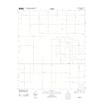
2012 Map of Ashmore
USGS Topo · Published 2012About this map
Adair and Ashmore anchor this section of the High Plains, where a geometric grid of county roads defines the agricultural and industrial landscape of Terry County. The regional economy is clearly marked by the Adair Oil Field, which occupies the northern reaches of the quadrangle. Transport and logistics in this part of West Texas are facilitated by a dense network of local routes, including FM-403 and Ranch Road 1067, alongside numbered paths like Co Rd-126 and Co Rd-132. The map reveals a highly structured pattern of land use, where the expansive flat terrain is subdivided into large rectangular plots typical of the region's ranching and petroleum heritage.
Find a feature on this map
25 named features on this map. Tap any name to fly to it.
Don’t see what you’re looking for? This feature index may not catch every label — zoom into the map to look around manually.
Map Details
Editions of this 2012 Ashmore Map
This is the sole edition of this map. No revisions or reprints were ever made.
Other maps of this area

1954 · Hobbs
USGS Topo · 1:250,000

1954 · Brownfield
USGS Topo · 1:250,000

1958 · Brownfield
USGS Topo · 1:250,000

1958 · Hobbs
USGS Topo · 1:250,000

1962 · Brownfield
USGS Topo · 1:250,000

1969 · Foster
USGS Topo · 1:24,000

1969 · Loop
USGS Topo · 1:24,000

1969 · Ashmore
USGS Topo · 1:24,000

1969 · Welch SW
USGS Topo · 1:24,000
1969 · Union School
USGS Topo · 1:24,000