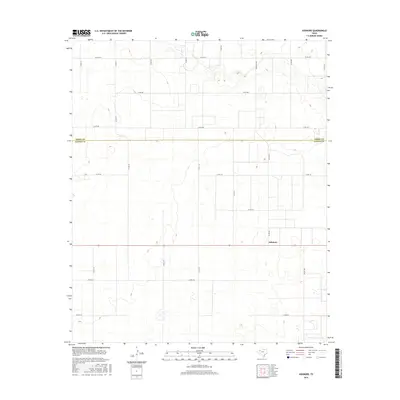
2016 Map of Ashmore
USGS Topo · Published 2016About this map
Ashmore sits at a crossroads in the High Plains of West Texas, marking a transition point between the agricultural lands of Terry Co and Gaines Co. This landscape is defined by its rectilinear grid of country roads, which facilitate the transport of crops across the level terrain. The intersection of Fm Rd 403 and various county arteries like Co Rd 130 and Co Rd 132 suggests a rural economy built on large-scale farming operations that rely on efficient regional access.
Find a feature on this map
23 named features on this map. Tap any name to fly to it.
Don’t see what you’re looking for? This feature index may not catch every label — zoom into the map to look around manually.
Map Details
Editions of this 2016 Ashmore Map
This is the sole edition of this map. No revisions or reprints were ever made.
Other maps of this area

1954 · Hobbs
USGS Topo · 1:250,000

1954 · Brownfield
USGS Topo · 1:250,000

1958 · Brownfield
USGS Topo · 1:250,000

1958 · Hobbs
USGS Topo · 1:250,000

1962 · Brownfield
USGS Topo · 1:250,000

1969 · Foster
USGS Topo · 1:24,000

1969 · Loop
USGS Topo · 1:24,000

1969 · Ashmore
USGS Topo · 1:24,000

1969 · Welch SW
USGS Topo · 1:24,000
1969 · Union School
USGS Topo · 1:24,000