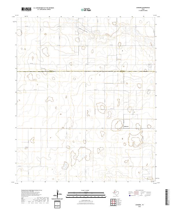
2022 Map of Ashmore
USGS Topo · Published 2022About this map
Sulphur Springs Draw meanders through the northern section of this High Plains landscape, cutting across a grid of agricultural and ranch roads. The settlement of Ashmore serves as a local landmark along the southern reaches of Fm Rd 403, marking a point of activity in an otherwise expansive rural terrain. This region is defined by the survey-line boundary between Terry Co and Gaines Co, which runs horizontally through the center of the sheet. The network of local infrastructure is dense with numbered routes such as Co Rd 670 and Co Rd 132, reflecting the systematic development of West Texas land for production. The map captures the subtle topography of the Llano Estacado, where drainage features like the draw are the primary breaks in the level elevation.
Find a feature on this map
25 named features on this map. Tap any name to fly to it.
Don’t see what you’re looking for? This feature index may not catch every label — zoom into the map to look around manually.
Map Details
Editions of this 2022 Ashmore Map
This is the sole edition of this map. No revisions or reprints were ever made.
Other maps of this area

1954 · Hobbs
USGS Topo · 1:250,000

1954 · Brownfield
USGS Topo · 1:250,000

1958 · Brownfield
USGS Topo · 1:250,000

1958 · Hobbs
USGS Topo · 1:250,000

1962 · Brownfield
USGS Topo · 1:250,000

1969 · Foster
USGS Topo · 1:24,000

1969 · Loop
USGS Topo · 1:24,000

1969 · Ashmore
USGS Topo · 1:24,000

1969 · Welch SW
USGS Topo · 1:24,000
1969 · Union School
USGS Topo · 1:24,000