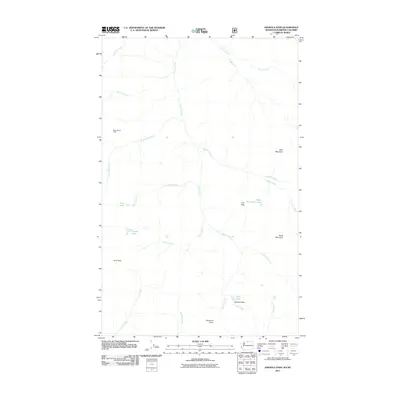
2011 Map of Ashnola Pass
USGS Topo · Published 2011About this map
Baker Brown Cabin stands as a solitary named human structure in this high-altitude landscape of northern Washington, where the Ashnola River flows northward toward the Canadian border. The drainage network is complex, fed by numerous creeks including Timber Wolf Creek, Spanish Creek, and Raven Creek. High points like Bald Mountain, Van Peak, and Freds Mountain define the topography, while mountain passes such as Ashnola Pass and Larch Pass indicate the natural travel corridors through this high country.
Find a feature on this map
26 named features on this map. Tap any name to fly to it.
Don’t see what you’re looking for? This feature index may not catch every label — zoom into the map to look around manually.
Map Details
Editions of this 2011 Ashnola Pass Map
This is the sole edition of this map. No revisions or reprints were ever made.
Other maps of this area

1955 · Concrete
USGS Topo · 1:250,000

1958 · Concrete
USGS Topo · 1:250,000

1962 · Concrete
USGS Topo · 1:250,000

1969 · Mt. Barney
USGS Topo · 1:24,000

1969 · Lost Peak
USGS Topo · 1:24,000

1969 · Remmel Mtn.
USGS Topo · 1:24,000
1969 · Ashnola Mtn
USGS Topo · 1:24,000

1969 · Billy Goat Mtn
USGS Topo · 1:24,000

1969 · Ashnola Pass
USGS Topo · 1:24,000
2002 · Billy Goat Mountain
USGS Topo · 1:24,000