
1969 Map of Lost Peak
USGS Topo · Published 1973About this map
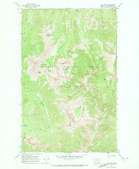
Okanogan National Forest and the Pasayten Wilderness define this high country landscape as it appeared in the late 1960s. The map captures a transition between the rugged topography of peaks like Lost Peak and Nanny Goat Mtn and the deep drainage of the Lost River Gorge. Human presence in this protected backcountry is marked primarily by seasonal shelters and primitive access routes, including Clints Cabin and the riverside Hoot Owl Camp. High-elevation water features such as Johnny Lakes and Rampart Lake are positioned along steep ridges, indicating a terrain where travel was dictated by the Monument Creek Trail and other historic pack routes. The placement of Many Trails Peak and the Three Pinnacles suggests a complex network of high-country waypoints for early forest rangers and wilderness travelers.
Find a feature on this map
37 named features on this map. Tap any name to fly to it.
Don’t see what you’re looking for? This feature index may not catch every label — zoom into the map to look around manually.
Map Details
Editions of this 1969 Lost Peak Map
2 editions found
Other maps of this area

1920 · Slate Pass
USGS Topo · 1:125,000

1955 · Concrete
USGS Topo · 1:250,000

1958 · Concrete
USGS Topo · 1:250,000

1962 · Concrete
USGS Topo · 1:250,000

1962 · Mazama
USGS Topo · 1:62,500
1963 · Robinson Mtn.
USGS Topo · 1:24,000
1969 · Ashnola Mtn
USGS Topo · 1:24,000

1969 · Tatoosh Buttes
USGS Topo · 1:24,000

1969 · Billy Goat Mtn
USGS Topo · 1:24,000

1969 · Ashnola Pass
USGS Topo · 1:24,000