
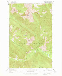
1962 Map of Mazama
USGS Topo · Published 1964About this map
Mazama serves as the central hub of this high-country landscape within the Okanogan National Forest, where the confluence of the Methow River and Lost River shapes the local geography. The map documents a rugged era of forest management and early recreation, marked by the presence of the Early Winters Ranger Station and various pack trails and early motor routes. A notable concentration of backcountry infrastructure is visible, including the Lost River Landing Strip and a series of fire-prevention and observation points like the Lookout Tower on Goat Peak. The presence of several Mine symbols and Prospects near Flagg Mtn suggests the area's history of mineral exploration. Transport through these peaks relied on critical crossings like Weeman Bridge and high-altitude passes such as Banker Pass and Rendezvous Pass, which connected the various drainage basins of Goat Creek and Eightmile Creek.
Find a feature on this map
106 named features on this map. Tap any name to fly to it.
Don’t see what you’re looking for? This feature index may not catch every label — zoom into the map to look around manually.
Map Details
Editions of this 1962 Mazama Map
This is the sole edition of this map. No revisions or reprints were ever made.
Other maps of this area

1899 · Methow
USGS Topo · 1:125,000

1901 · Methow
USGS Topo · 1:125,000

1902 · Stehekin
USGS Topo · 1:125,000

1904 · Stehekin
USGS Topo · 1:125,000

1920 · Slate Pass
USGS Topo · 1:125,000

1955 · Concrete
USGS Topo · 1:250,000

1958 · Concrete
USGS Topo · 1:250,000

1962 · Concrete
USGS Topo · 1:250,000

1963 · Silver Star Mtn.
USGS Topo · 1:24,000
1963 · Robinson Mtn.
USGS Topo · 1:24,000