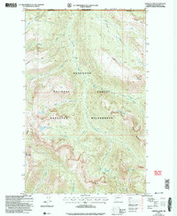
2002 Map of Ashnola Pass
USGS Topo · Published 2006About this map
Okanogan National Forest and the Pasayten Wilderness define this high-altitude landscape along the United States and Canada border. The Ashnola River carves a central path through the terrain, fed by a complex drainage system including Wolf Creek, Spanish Creek, and Diamond Creek. This 2002 revision shows a region primarily shaped by natural features and trail access rather than permanent settlement.
Find a feature on this map
40 named features on this map. Tap any name to fly to it.
Don’t see what you’re looking for? This feature index may not catch every label — zoom into the map to look around manually.
Map Details
Editions of this 2002 Ashnola Pass Map
This is the sole edition of this map. No revisions or reprints were ever made.
Other maps of this area

1955 · Concrete
USGS Topo · 1:250,000

1958 · Concrete
USGS Topo · 1:250,000

1962 · Concrete
USGS Topo · 1:250,000

1969 · Mt. Barney
USGS Topo · 1:24,000

1969 · Lost Peak
USGS Topo · 1:24,000

1969 · Remmel Mtn.
USGS Topo · 1:24,000
1969 · Ashnola Mtn
USGS Topo · 1:24,000

1969 · Billy Goat Mtn
USGS Topo · 1:24,000

1969 · Ashnola Pass
USGS Topo · 1:24,000
2002 · Billy Goat Mountain
USGS Topo · 1:24,000