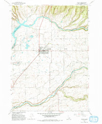
1965 Map of Ashton
USGS Topo · Published 1993About this map
The agricultural and hydraulic development of the Upper Snake River Valley defines this mid-century portrait of Ashton and its surrounding countryside. Centered on the town and the neighboring settlement of Marysville, the map illustrates a complex network of irrigation infrastructure essential to the region's potato and grain farming, including the Farmers Own Canal and the Marysville Canal. The landscape is dominated by the confluence of major water systems, where the Henrys Fork and Falls River carve through the terrain, managed by structures like the Ashton Dam and a Diversion Dam. Local landmarks such as the Ashton Fish Hatchery and the High School reflect the community's established social and economic foundations. To the northeast, the map transitions from these developed farmsteads into the timbered slopes of the Targhee National Forest, marked by canyons like Putney Canyon and Coleman Canyon.
Find a feature on this map
30 named features on this map. Tap any name to fly to it.
Don’t see what you’re looking for? This feature index may not catch every label — zoom into the map to look around manually.
Map Details
Editions of this 1965 Ashton Map
3 editions found
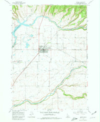
Other maps of this area

1949 · Newdale
USGS Topo · 1:24,000

1950 · Newdale
USGS Topo · 1:24,000

1955 · Ashton
USGS Topo · 1:250,000

1955 · Driggs
USGS Topo · 1:250,000

1958 · Driggs
USGS Topo · 1:250,000

1958 · Ashton
USGS Topo · 1:250,000

1960 · Ashton
USGS Topo · 1:250,000

1962 · Driggs
USGS Topo · 1:250,000

1965 · Lemon Lake
USGS Topo · 1:24,000

1965 · Ashton
USGS Topo · 1:24,000