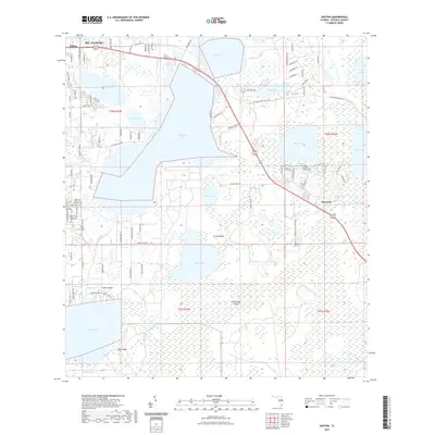
2021 Map of Ashton
USGS Topo · Published 2021About this map
The master-planned community of Harmony and the southeastern edge of St. Cloud define this portion of Osceola County in the early 2020s. This region is a labyrinth of freshwater basins and wetlands, where large bodies of water like Alligator Lake, Lake Lizzie, and Buck Lake dominate the landscape. The layout of the land reflects a transition from older rural settlements like Ashton to modern equestrian-themed developments, seen in the intricate street networks of Running Horse Trl and Maverick Trl.
Find a feature on this map
93 named features on this map. Tap any name to fly to it.
Don’t see what you’re looking for? This feature index may not catch every label — zoom into the map to look around manually.
Map Details
Editions of this 2021 Ashton Map
This is the sole edition of this map. No revisions or reprints were ever made.
Other maps of this area

1953 · Cypress Lake
USGS Topo · 1:24,000

1953 · Holopaw SE
USGS Topo · 1:24,000

1953 · Narcoossee SE
USGS Topo · 1:24,000

1953 · St Cloud North
USGS Topo · 1:24,000

1953 · Narcoossee
USGS Topo · 1:24,000

1953 · St Cloud South
USGS Topo · 1:24,000

1953 · Holopaw SW
USGS Topo · 1:24,000

1953 · Ashton
USGS Topo · 1:24,000

1953 · Holopaw
USGS Topo · 1:24,000

1955 · Orlando
USGS Topo · 1:250,000