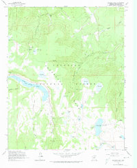
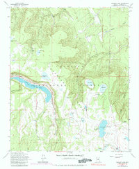
1962 Map of Ashurst Lake
USGS Topo · Published 1974About this map
Anderson Mesa dominates the central landscape of this Coconino National Forest survey, providing a distinct geographic foundation for the region's high-altitude water management system. The map documents the extensive network of cattle tanks and natural basins, including Ashurst Lake and the southeastern reach of Upper Lake Mary. These water sources, such as Youngs Lake and Potato Lake, were critical for both local recreation and the timber or ranching operations that defined this era in Arizona history.
Find a feature on this map
44 named features on this map. Tap any name to fly to it.
Don’t see what you’re looking for? This feature index may not catch every label — zoom into the map to look around manually.
Map Details
Editions of this 1962 Ashurst Lake Map
5 editions found
Other maps of this area

1886 · San Francisco Mtns
USGS Topo · 1:250,000

1887 · Verde
USGS Topo · 1:250,000

1891 · San Francisco Mtns
USGS Topo · 1:250,000

1892 · Verde
USGS Topo · 1:250,000

1894 · San Francisco Mtns
USGS Topo · 1:250,000

1899 · San Francisco Mtns
USGS Topo · 1:250,000

1908 · Flagstaff
USGS Topo · 1:125,000

1912 · Flagstaff
USGS Topo · 1:125,000

1923 · Camp Verde
USGS Topo · 1:125,000

1932 · Camp Verde
USGS Topo · 1:125,000