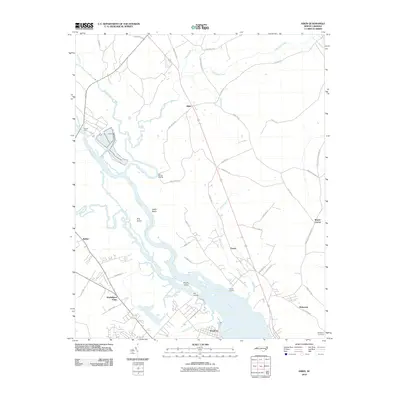
2010 Map of Askin
USGS Topo · Published 2010About this map
The Neuse River and its intricate tributaries dominate this coastal Carolina landscape, where Swift Creek and Little Swift Creek converge amidst an extensive network of wetlands. Small crossroads and landings define the human footprint, from the settlement of Askin in the north to the expanding residential patterns near Washington Forks in the south. The river's influence is clear through the naming of local features like Hog Island, Marsh Island, and recreational points such as Gatlin Beach and Cool Springs Landing.
Find a feature on this map
51 named features on this map. Tap any name to fly to it.
Don’t see what you’re looking for? This feature index may not catch every label — zoom into the map to look around manually.
Map Details
Editions of this 2010 Askin Map
This is the sole edition of this map. No revisions or reprints were ever made.
Other maps of this area

1901 · New Bern
USGS Topo · 1:62,500

1902 · Vanceboro
USGS Topo · 1:62,500

1903 · New Bern
USGS Topo · 1:62,500

1904 · Vanceboro
USGS Topo · 1:62,500

1905 · Vanceboro
USGS Topo · 1:62,500

1950 · Pollocksville
USGS Topo · 1:24,000

1950 · New Bern
USGS Topo · 1:24,000

1950 · Edward
USGS Topo · 1:24,000

1950 · Upper Broad Creek
USGS Topo · 1:24,000

1951 · Upper Broad Creek
USGS Topo · 1:24,000