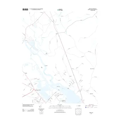
2013 Map of Askin
USGS Topo · Published 2013About this map
The Neuse River dominates this portion of Craven County, North Carolina, forming a complex network of wetlands and channels including The Gut, Shad Cove, and Rennys Cr. Along the western banks, the landscape transitions from the river's edge at Gatlin Beach and Hog Island toward established residential developments near Washington Forks and the outskirts of Bellair. The map illustrates a contemporary pattern of suburban growth and traditional river-dependent geography, where modern roads like the New Bern Byp intersect with older access points such as Streets Ferry and Cool Springs Landing. To the north and east, the terrain becomes increasingly marshy, defined by Beaverdam Swamp, Fisher Swamp, and Kit Swamp, which isolate small rural settlements like Askin and Rowes Corner. This 2013 survey provides a detailed look at the interface between the coastal plains' wetlands and the expanding residential footprint of the New Bern area.
Find a feature on this map
98 named features on this map. Tap any name to fly to it.
Don’t see what you’re looking for? This feature index may not catch every label — zoom into the map to look around manually.
Map Details
Editions of this 2013 Askin Map
This is the sole edition of this map. No revisions or reprints were ever made.
Other maps of this area

1901 · New Bern
USGS Topo · 1:62,500

1902 · Vanceboro
USGS Topo · 1:62,500

1903 · New Bern
USGS Topo · 1:62,500

1904 · Vanceboro
USGS Topo · 1:62,500

1905 · Vanceboro
USGS Topo · 1:62,500

1950 · Pollocksville
USGS Topo · 1:24,000

1950 · New Bern
USGS Topo · 1:24,000

1950 · Edward
USGS Topo · 1:24,000

1950 · Upper Broad Creek
USGS Topo · 1:24,000

1951 · Upper Broad Creek
USGS Topo · 1:24,000