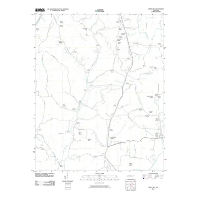
2010 Map of Aspen Hill
USGS Topo · Published 2010About this map
Prospect Station and the Prospect Post Office anchor the southeastern corner of this Giles County landscape, where the local economy follows the winding paths of Richland Creek and the Elk River. The terrain is defined by a dense network of hollows, such as Stovall Hollow and Yarborough Hollow, which have historically dictated the placement of homesteads and family cemeteries. Notable for its genealogical density, the map records numerous burial sites including the Stella Cemetery, Pleasant Hill Cemetery, and the Shores Cemetery. Water crossings like Minnow Ford on the East Fork Shoal Creek highlight the rural infrastructure of the era, while landmarks like Winding Stair Bluff and Adams Hill provide distinct topographic orientation within the complex valley system.
Find a feature on this map
119 named features on this map. Tap any name to fly to it.
Don’t see what you’re looking for? This feature index may not catch every label — zoom into the map to look around manually.
Map Details
Editions of this 2010 Aspen Hill Map
This is the sole edition of this map. No revisions or reprints were ever made.
Other maps of this area

1888 · Huntsville
USGS Topo · 1:125,000

1892 · Huntsville
USGS Topo · 1:125,000

1936 · Union Hill
USGS Topo · 1:24,000

1936 · Aspen Hill
USGS Topo · 1:24,000

1936 · Elkmont
USGS Topo · 1:24,000

1936 · Pulaski
USGS Topo · 1:24,000

1936 · Bodenham
USGS Topo · 1:24,000

1936 · Appleton
USGS Topo · 1:24,000

1936 · Tarpley
USGS Topo · 1:24,000

1936 · Elkton
USGS Topo · 1:24,000