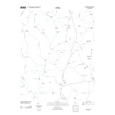
2013 Map of Aspen Hill
USGS Topo · Published 2013About this map
Aspen Hill and the surrounding southern Giles County landscape are defined by a dense network of hollows and small watercourses that drain into the Elk River. This modern survey reveals a highly distributed settlement pattern where small communities like Stella, Kedron, and Bethel are linked by winding country roads that follow the contours of the terrain. The presence of numerous family-named geographic features, such as Yarborough Hollow and Hargrove Hollow, indicates a deep ancestral connection to the land. Along the southern edge, the Winding Stair Bluff stands above the river valley near Elder Spring, while to the north, Minnow Ford provides a crossing point for Hanna Br. The map documents a rural Tennessee economy still shaped by its physical geography, from the creek bottoms like Mud Bottom to the elevated ridges of Barksdale Ridge.
Find a feature on this map
125 named features on this map. Tap any name to fly to it.
Don’t see what you’re looking for? This feature index may not catch every label — zoom into the map to look around manually.
Map Details
Editions of this 2013 Aspen Hill Map
This is the sole edition of this map. No revisions or reprints were ever made.
Other maps of this area

1888 · Huntsville
USGS Topo · 1:125,000

1892 · Huntsville
USGS Topo · 1:125,000

1936 · Union Hill
USGS Topo · 1:24,000

1936 · Aspen Hill
USGS Topo · 1:24,000

1936 · Elkmont
USGS Topo · 1:24,000

1936 · Pulaski
USGS Topo · 1:24,000

1936 · Bodenham
USGS Topo · 1:24,000

1936 · Appleton
USGS Topo · 1:24,000

1936 · Tarpley
USGS Topo · 1:24,000

1936 · Elkton
USGS Topo · 1:24,000