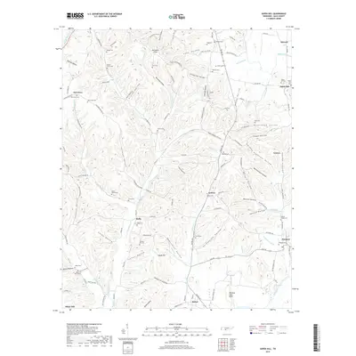
2019 Map of Aspen Hill
USGS Topo · Published 2019About this map
Barksdale Ridge and Adams Hill rise above a landscape defined by an intricate network of hollows and creek branches in this southern Tennessee survey. The settlement pattern is characterized by numerous small communities and crossroads such as Stella, Kedron, and Aspen Hill. For genealogists, the map is particularly rich in family-named landmarks and small burial grounds, including Massey Cem, Fogg Cem, and the Shoal Bluff Cem. The drainage system is dominated by the W Fork Shoal Cr and the E Fork Shoal Cr, which carve through deep depressions like Kellum Hollow and Graves Hollow. In the southeast, the Elk River flows near Prospect, while the dramatic Winding Stair Bluff provides a notable topographical landmark near the community of Bethel.
Find a feature on this map
123 named features on this map. Tap any name to fly to it.
Don’t see what you’re looking for? This feature index may not catch every label — zoom into the map to look around manually.
Map Details
Editions of this 2019 Aspen Hill Map
This is the sole edition of this map. No revisions or reprints were ever made.
Other maps of this area

1888 · Huntsville
USGS Topo · 1:125,000

1892 · Huntsville
USGS Topo · 1:125,000

1936 · Union Hill
USGS Topo · 1:24,000

1936 · Aspen Hill
USGS Topo · 1:24,000

1936 · Elkmont
USGS Topo · 1:24,000

1936 · Pulaski
USGS Topo · 1:24,000

1936 · Bodenham
USGS Topo · 1:24,000

1936 · Appleton
USGS Topo · 1:24,000

1936 · Tarpley
USGS Topo · 1:24,000

1936 · Elkton
USGS Topo · 1:24,000