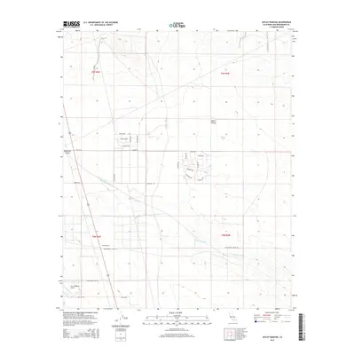
2015 Map of Astley Rancho
USGS Topo · Published 2015About this map
Astley Rancho serves as a focal point in this high desert landscape, situated within the arid expanse of the Mojave Desert in San Bernardino County. The area's geography is defined by the drainage patterns of Buckthorn Wash, which cuts across the terrain from Buckthorn Canyon. In the southern reaches, the Sun Hill Ranch Airport reflects the region's reliance on small-scale aviation for connectivity across the dry basins. The road network is a mixture of established routes like Macon Rd and Sunhill Rd, alongside several residential-style corridors such as Princeton Rd and Kingman Rd. The presence of the Princess Pat Mine Rd points to the historical mining activity common in this portion of the California desert, where infrastructure often followed early mineral prospecting routes.
Find a feature on this map
28 named features on this map. Tap any name to fly to it.
Don’t see what you’re looking for? This feature index may not catch every label — zoom into the map to look around manually.
Map Details
Editions of this 2015 Astley Rancho Map
This is the sole edition of this map. No revisions or reprints were ever made.
Other maps of this area

1932 · Barstow
USGS Topo · 1:125,000

1934 · Barstow
USGS Topo · 1:125,000

1937 · Shadow Mountains
USGS Topo · 1:48,000

1937 · Kramer
USGS Topo · 1:48,000

1942 · Kramer
USGS Topo · 1:62,500

1942 · Shadow Mountains
USGS Topo · 1:62,500

1947 · Kramer
USGS Topo · 1:24,000

1947 · Red Buttes
USGS Topo · 1:24,000

1953 · San Bernardino
USGS Topo · 1:250,000
1955 · Shadow Mountains
USGS Topo · 1:24,000