
1947 Map of Red Buttes
USGS Topo · Published 1947About this map
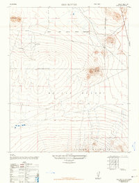
Muroc Army Airfield Military Reservation dominates the northern reaches of this post-war landscape, situated within a vast expanse of the Mojave Desert. Compiled by the Army Map Service from aerial photography taken in 1946, the sheet documents a high-desert environment defined by prominent peaks and military activity. To the north, Hay Stack Butte rises above the airfield boundaries, while several Observation towers are positioned at strategic elevations to oversee operations across the terrain. The southern portion of the survey transitions into the craggy heights of the Shadow Mountains, creating a natural border against the flatter desert floor. Centered between these landforms are the eponymous Red Buttes, providing a clear visual landmark in a region characterized by its expansive grid of military reservations and undeveloped desert reaches during the mid-forties.
Find a feature on this map
7 named features on this map. Tap any name to fly to it.
Don’t see what you’re looking for? This feature index may not catch every label — zoom into the map to look around manually.
Map Details
Editions of this 1947 Red Buttes Map
2 editions found
Other maps of this area

1931 · Adobe
USGS Topo · 1:24,000

1932 · Barstow
USGS Topo · 1:125,000

1934 · Barstow
USGS Topo · 1:125,000

1934 · Adobe
USGS Topo · 1:24,000

1937 · Shadow Mountains
USGS Topo · 1:48,000

1937 · Kramer
USGS Topo · 1:48,000

1942 · Kramer
USGS Topo · 1:62,500

1942 · Shadow Mountains
USGS Topo · 1:62,500

1947 · Kramer
USGS Topo · 1:24,000

1947 · Rich
USGS Topo · 1:24,000