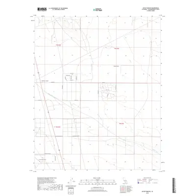
2018 Map of Astley Rancho
USGS Topo · Published 2018About this map
The Mojave Desert terrain dominates this portion of San Bernardino County, where seasonal drainage patterns are etched into the landscape by the Buckthorn Wash. In the southwestern corner, the Sun Hill Ranch Airport serves as a remote hub for the area, located near Monte Vista Rd. The map reveals a grid of rural residential streets including Augusta Rd, Princeton Rd, and Kingman Rd, suggesting a pocket of desert living. Local industry and historical activity are hinted at by the presence of Princess Pat Mine Rd, while the natural topography is defined by the depth of Buckthorn Canyon. This survey captures the transition between organized township roads and the open arid expanses of the high desert.
Find a feature on this map
26 named features on this map. Tap any name to fly to it.
Don’t see what you’re looking for? This feature index may not catch every label — zoom into the map to look around manually.
Map Details
Editions of this 2018 Astley Rancho Map
This is the sole edition of this map. No revisions or reprints were ever made.
Other maps of this area

1932 · Barstow
USGS Topo · 1:125,000

1934 · Barstow
USGS Topo · 1:125,000

1937 · Shadow Mountains
USGS Topo · 1:48,000

1937 · Kramer
USGS Topo · 1:48,000

1942 · Kramer
USGS Topo · 1:62,500

1942 · Shadow Mountains
USGS Topo · 1:62,500

1947 · Kramer
USGS Topo · 1:24,000

1947 · Red Buttes
USGS Topo · 1:24,000

1953 · San Bernardino
USGS Topo · 1:250,000
1955 · Shadow Mountains
USGS Topo · 1:24,000