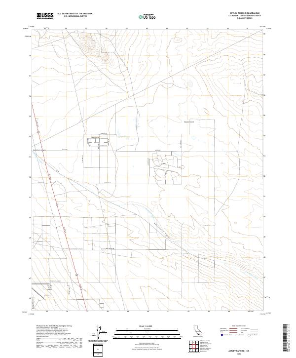
2021 Map of Astley Rancho
USGS Topo · Published 2021About this map
Buckthorn Wash and the surrounding high desert of the Mojave Desert define this segment of San Bernardino County, where the transition from rugged mountain slopes to alluvial plains is marked by a sparse but deliberate grid of roads. The Shadow Mountains rise in the southwest, framing a landscape where transportation corridors like Us Rte 395 serve as the primary lifelines between remote outposts. Settlement is concentrated in small pockets of residential development north of Macon Rd, with a planned street network including Augusta Rd and Lafayette Ave hinting at localized growth.
Find a feature on this map
28 named features on this map. Tap any name to fly to it.
Don’t see what you’re looking for? This feature index may not catch every label — zoom into the map to look around manually.
Map Details
Editions of this 2021 Astley Rancho Map
This is the sole edition of this map. No revisions or reprints were ever made.
Other maps of this area

1932 · Barstow
USGS Topo · 1:125,000

1934 · Barstow
USGS Topo · 1:125,000

1937 · Shadow Mountains
USGS Topo · 1:48,000

1937 · Kramer
USGS Topo · 1:48,000

1942 · Kramer
USGS Topo · 1:62,500

1942 · Shadow Mountains
USGS Topo · 1:62,500

1947 · Kramer
USGS Topo · 1:24,000

1947 · Red Buttes
USGS Topo · 1:24,000

1953 · San Bernardino
USGS Topo · 1:250,000
1955 · Shadow Mountains
USGS Topo · 1:24,000