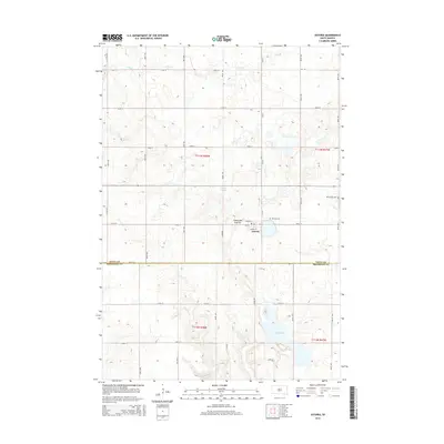
2015 Map of Astoria
USGS Topo · Published 2015About this map
The town of Astoria sits atop the Coteau des Prairies, a vast plateau that shapes the geography of eastern South Dakota. This 2015 survey reveals a landscape defined by the traditional grid of the Public Land Survey System, where sections are clearly marked by gravel roads and section lines like 482nd Ave and 195th St. Water is a defining feature of the local terrain, appearing in the form of glacial depressions and drainages such as Cobb Cr and Oak Lake. For genealogists and local historians, the map identifies specific community landmarks including Bethany Cem and Bethlehem Cem, alongside geological features like Jorstad Spring. The boundary between Deuel County and Brookings County crosses the southern portion of the sheet, illustrating how these political divisions overlay the natural contours of the high prairie.
Find a feature on this map
30 named features on this map. Tap any name to fly to it.
Don’t see what you’re looking for? This feature index may not catch every label — zoom into the map to look around manually.
Map Details
Editions of this 2015 Astoria Map
This is the sole edition of this map. No revisions or reprints were ever made.
Other maps of this area

1953 · Watertown
USGS Topo · 1:250,000

1958 · Watertown
USGS Topo · 1:250,000

1967 · Canby NW
USGS Topo · 1:24,000

1967 · Lake Benton NW
USGS Topo · 1:24,000

1967 · Hendricks
USGS Topo · 1:24,000

1970 · Brandt
USGS Topo · 1:24,000

1970 · White NE
USGS Topo · 1:24,000

1970 · Astoria
USGS Topo · 1:24,000

1970 · White
USGS Topo · 1:24,000

1970 · Clear Lake South
USGS Topo · 1:24,000
Featured Places
- Astoria, SD
- Scandinavia Township, SD
- Lake Hendricks Township, SD
- Oaklake Township, SD
- Brookings County, SD