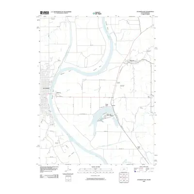
2009 Map of Atchison East
USGS Topo · Published 2009About this map
Atchison anchors this riverfront landscape, where the Missouri River forms a complex series of loops including Doniphan Bend and McQueen Bend. The settlement pattern follows the river's eastern bank through small communities like Rushville, Armour, and Winthrop, while the western bluffs are defined by significant cemetery sites including Cummings Cemetery and Taylor Cemetery. The hydrology of the floodplain is particularly intricate here, featuring Horseshoe Slough and Sugar Lake, alongside the notable Dead Mans Hole Dam. The map documents a blend of established river towns and residential clusters like Lewis and Clark Village, connected by a network of rural routes such as Old Highway Rd SW and SW Morrow Rd.
Find a feature on this map
69 named features on this map. Tap any name to fly to it.
Don’t see what you’re looking for? This feature index may not catch every label — zoom into the map to look around manually.
Map Details
Editions of this 2009 Atchison East Map
This is the sole edition of this map. No revisions or reprints were ever made.
Other maps of this area

1885 · Atchison
USGS Topo · 1:125,000

1886 · Oskaloosa
USGS Topo · 1:125,000

1888 · Oskaloosa
USGS Topo · 1:125,000

1888 · Atchison
USGS Topo · 1:125,000

1890 · Kansas City
USGS Topo · 1:125,000

1893 · Atchison
USGS Topo · 1:125,000

1894 · Kansas City
USGS Topo · 1:125,000

1894 · Oskaloosa
USGS Topo · 1:125,000

1910 · Leavenworth
USGS Topo · 1:62,500

1926 · Atchison
USGS Topo · 1:62,500