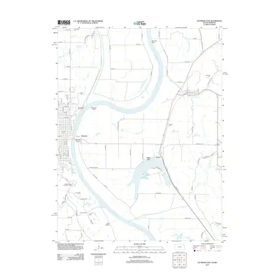
2012 Map of Atchison East
USGS Topo · Published 2012About this map
The Missouri River meanders through this riverine landscape, defining a series of sharp loops including Doniphan Bend, McQueen Bend, and Atchison Bend. These river dynamics have created a complex of oxbow lakes and wetlands, most notably Sugar Lake, Lewis and Clark Lake, and the smaller Mud Lake. The terrain is marked by significant cultural landmarks, particularly on the western bluffs where the Benedictine Coll and Saint Benedicts Abbey Cem overlook the valley. Settlement patterns are focused around the river crossings and lower-lying areas like Winthrop and Armour, which are protected by extensive engineering works such as Halls Levee. Numerous small family and community burial grounds, including Taylor Cem, Hudseph Cem, and Sumner Cem, are scattered across the uplands, offering clear reference points for genealogical research in this border region between Kansas and Missouri.
Find a feature on this map
103 named features on this map. Tap any name to fly to it.
Don’t see what you’re looking for? This feature index may not catch every label — zoom into the map to look around manually.
Map Details
Editions of this 2012 Atchison East Map
This is the sole edition of this map. No revisions or reprints were ever made.
Other maps of this area

1885 · Atchison
USGS Topo · 1:125,000

1886 · Oskaloosa
USGS Topo · 1:125,000

1888 · Oskaloosa
USGS Topo · 1:125,000

1888 · Atchison
USGS Topo · 1:125,000

1890 · Kansas City
USGS Topo · 1:125,000

1893 · Atchison
USGS Topo · 1:125,000

1894 · Kansas City
USGS Topo · 1:125,000

1894 · Oskaloosa
USGS Topo · 1:125,000

1910 · Leavenworth
USGS Topo · 1:62,500

1926 · Atchison
USGS Topo · 1:62,500