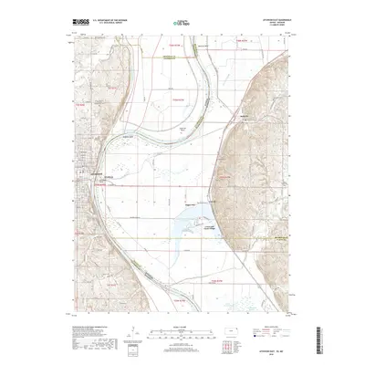
2018 Map of Atchison East
USGS Topo · Published 2018About this map
Atchison and its eastern neighbors across the Missouri River appear here in detail along the border of Kansas and Missouri. This riverfront landscape is defined by its sweeping meanders, including McQueen Bend and Atchison Bend, which have historically dictated the placement of settlements and transport routes. On the Kansas side, the topography rises toward landmarks like the Saint Benedicts Abbey Cem and the State of Kansas Childrens Orphan Home Cem, reflecting the area's established institutional and religious history. East of the river, the Missouri bottomlands are dotted with oxbow features like Sugar Lake and the small community of Lewis and Clark Village. The map reveals how the floodplains accommodate small clusters like Winthrop and Armour while higher ground in the east supports the village of Rushville, surrounded by family-named plots like Gore Cem and Sugar Creek Cem.
Find a feature on this map
71 named features on this map. Tap any name to fly to it.
Don’t see what you’re looking for? This feature index may not catch every label — zoom into the map to look around manually.
Map Details
Editions of this 2018 Atchison East Map
This is the sole edition of this map. No revisions or reprints were ever made.
Other maps of this area

1885 · Atchison
USGS Topo · 1:125,000

1886 · Oskaloosa
USGS Topo · 1:125,000

1888 · Oskaloosa
USGS Topo · 1:125,000

1888 · Atchison
USGS Topo · 1:125,000

1890 · Kansas City
USGS Topo · 1:125,000

1893 · Atchison
USGS Topo · 1:125,000

1894 · Kansas City
USGS Topo · 1:125,000

1894 · Oskaloosa
USGS Topo · 1:125,000

1910 · Leavenworth
USGS Topo · 1:62,500

1926 · Atchison
USGS Topo · 1:62,500