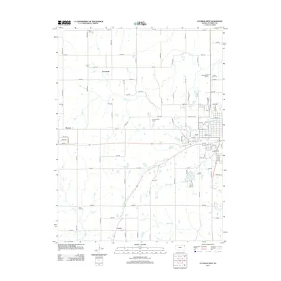
2012 Map of Atchison West
USGS Topo · Published 2012About this map
Amelia Earhart Airport serves as a central landmark in this Atchison County landscape, where the prairie transitions into the western outskirts of the city. The area is notable for its high concentration of local heritage sites, particularly its numerous cemeteries such as Oak Hill Cem, Mount Calvary Cem, and Mount Saint Scholastica Cem, which reflect the community's deep-rooted history. Small settlements and crossroads like Good Intent, Shannon, and Parnell are linked by a precise grid of rural roads, including Morton Rd and Pawnee Rd. Natural drainage patterns are defined by several waterways, most notably White Clay Cr and Deer Cr, which carve through the agricultural fields and development. The presence of the Northeast Kansas Technical Coll further illustrates the modern educational infrastructure integrated into this traditional Kansas setting.
Find a feature on this map
81 named features on this map. Tap any name to fly to it.
Don’t see what you’re looking for? This feature index may not catch every label — zoom into the map to look around manually.
Map Details
Editions of this 2012 Atchison West Map
This is the sole edition of this map. No revisions or reprints were ever made.
Other maps of this area

1885 · Atchison
USGS Topo · 1:125,000

1886 · Oskaloosa
USGS Topo · 1:125,000

1888 · Oskaloosa
USGS Topo · 1:125,000

1888 · Atchison
USGS Topo · 1:125,000

1893 · Atchison
USGS Topo · 1:125,000

1894 · Oskaloosa
USGS Topo · 1:125,000

1926 · Atchison
USGS Topo · 1:62,500

1948 · Oak Mills
USGS Topo · 1:24,000

1950 · Kansas City
USGS Topo · 1:250,000
1951 · Oak Mills
USGS Topo · 1:24,000