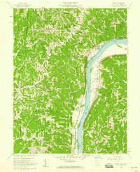
1958 Map of Athalia
USGS Topo · Published 1959About this map
The Ohio River dominates the central corridor of this 1950s survey, marking the border between the hills of Rome Township and the Union district. This river-centered landscape highlights the historical reliance on the waterway and the Baltimore and Ohio railroad for movement and trade. Small farming and residential clusters like Athalia, Crown City, and Miller line the narrow fertile plains adjacent to the water, while the interior is defined by steep ridges and winding creeks.
Find a feature on this map
59 named features on this map. Tap any name to fly to it.
Don’t see what you’re looking for? This feature index may not catch every label — zoom into the map to look around manually.
Map Details
Editions of this 1958 Athalia Map
This is the sole edition of this map. No revisions or reprints were ever made.
Other maps of this area

1892 · Huntington
USGS Topo · 1:125,000

1898 · Huntington
USGS Topo · 1:125,000

1901 · Guyandot
USGS Topo · 1:62,500

1902 · Guyandot
USGS Topo · 1:62,500

1902 · Milton
USGS Topo · 1:62,500

1906 · Athalia
USGS Topo · 1:62,500

1906 · Glenwood
USGS Topo · 1:62,500

1908 · Athalia
USGS Topo · 1:62,500

1908 · Glenwood
USGS Topo · 1:62,500

1931 · Milton
USGS Topo · 1:62,500