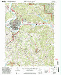
2002 Map of Athens
USGS Topo · Published 2005About this map
The Hocking River winds through the heart of Athens in this 2002 revision, illustrating the expansion of Ohio University and the surrounding residential communities of La Mar Heights and Longview Heights. The map reveals a landscape defined by collegiate infrastructure, including the Stadium and Golf Course, contrasted with the industrial presence of Strip Mines and a Gravel Pit on the city's periphery. To the north and east, the transition from urban density to the protected woodlands of Strouds Run State Park and Wayne National Forest is clear, with numerous Forest Service roads like fr35 and fr23 penetrating the ridges.
Find a feature on this map
82 named features on this map. Tap any name to fly to it.
Don’t see what you’re looking for? This feature index may not catch every label — zoom into the map to look around manually.
Map Details
Editions of this 2002 Athens Map
This is the sole edition of this map. No revisions or reprints were ever made.
Other maps of this area

1903 · Athens
USGS Topo · 1:62,500

1904 · Chesterhill
USGS Topo · 1:62,500

1905 · Athens
USGS Topo · 1:62,500

1906 · Chesterhill
USGS Topo · 1:62,500

1907 · Pomeroy
USGS Topo · 1:62,500

1907 · Keno
USGS Topo · 1:62,500

1947 · Columbus
USGS Topo · 1:250,000

1949 · Clarksburg
USGS Topo · 1:250,000

1956 · Clarksburg
USGS Topo · 1:250,000

1960 · Albany
USGS Topo · 1:24,000