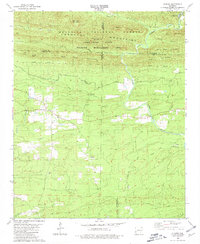
1980 Map of Athens
USGS Topo · Published 1981About this map
The Athens settlement and the nearby community of Henry sit at the intersection of a complex mountain landscape where the Ouachita National Forest meets managed wildlife lands. The terrain is defined by high ridges like Big Tom Mountain and Paul Mountain, with the Little Missouri River and the Saline River carving through the valleys. This 1980 survey captures the area's rural character, showing the distribution of family and community landmarks such as White Oak Cem, Pullman Cem, and Mizels Chapel. Small-scale industrial activity is evident in the Slate Pit and Shale Pit located south of the primary settlement. The northern portion of the map highlights the transition into the Albert Pike Recreation Area, where numerous mountain branches like Greasy Branch and Viles Branch feed into the larger river systems.
Find a feature on this map
40 named features on this map. Tap any name to fly to it.
Don’t see what you’re looking for? This feature index may not catch every label — zoom into the map to look around manually.
Map Details
Editions of this 1980 Athens Map
2 editions found
Other maps of this area

1906 · Caddo Gap
USGS Topo · 1:125,000

1913 · De Queen
USGS Topo · 1:125,000

1936 · Athens
USGS Topo · 1:48,000

1942 · Athens
USGS Topo · 1:62,500

1950 · Mcalester
USGS Topo · 1:250,000

1955 · Little Rock
USGS Topo · 1:250,000

1956 · Little Rock
USGS Topo · 1:250,000

1959 · Umpire
USGS Topo · 1:62,500

1960 · Little Rock
USGS Topo · 1:250,000

1962 · McAlester
USGS Topo · 1:250,000