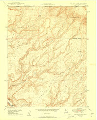
1950 Map of Atkinson Creek
USGS Topo · Published 1950About this map
The San Miguel River carves through the southwestern corner of this 1950 survey, marking the industrial importance of Uravan during the post-war uranium boom. This edition was produced in collaboration with the United States Atomic Energy Commission, reflecting the area's strategic significance for mineral extraction. The complex topography is defined by the Atkinson Breaks and the expansive Spring Mesa, where the Wright Mine stands as a primary landmark of the local mining economy.
Find a feature on this map
31 named features on this map. Tap any name to fly to it.
Don’t see what you’re looking for? This feature index may not catch every label — zoom into the map to look around manually.
Map Details
Editions of this 1950 Atkinson Creek Map
2 editions found
Other maps of this area

1916 · Paradox Valley
USGS Topo · 1:125,000

1922 · Paradox Valley
USGS Topo · 1:125,000

1948 · Uravan
USGS Topo · 1:24,000

1949 · Davis Mesa
USGS Topo · 1:24,000

1949 · Uravan
USGS Topo · 1:24,000

1949 · Atkinson Creek
USGS Topo · 1:24,000

1949 · Red Canyon
USGS Topo · 1:24,000

1949 · Calamity Mesa
USGS Topo · 1:24,000

1950 · Calamity Mesa
USGS Topo · 1:24,000

1950 · Atkinson Creek
USGS Topo · 1:24,000