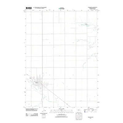
2011 Map of Atkinson
USGS Topo · Published 2011About this map
Atkinson serves as the focal point of this Holt County landscape, positioned where the Elkhorn River meets a network of local transport and water infrastructure. The town's grid is anchored by the Atkinson Post Office and extends toward the Woodlawn Cemetery on its western edge. A notable engineering detail is the Mill Race, which diverts water from the river near the town center, a remnant of early industrial water-power usage. Beyond the residential streets like N Madison St and E Pearl St, the terrain transitions into a strictly managed section-line road system. To the northeast, the Eagle Creek Dam contains the Eagle Creek Reservoir, while the Middle Branch Eagle Creek and Dry Creek drain the surrounding agricultural plains. This map illustrates the intersection of Nebraska’s river-valley settlement patterns with modern water management and the enduring platting of the high plains.
Find a feature on this map
19 named features on this map. Tap any name to fly to it.
Don’t see what you’re looking for? This feature index may not catch every label — zoom into the map to look around manually.
Map Details
Editions of this 2011 Atkinson Map
This is the sole edition of this map. No revisions or reprints were ever made.
Other maps of this area

1954 · Atkinson SE
USGS Topo · 1:24,000

1954 · Atkinson
USGS Topo · 1:24,000

1954 · Stuart SE
USGS Topo · 1:24,000

1954 · Atkinson NW
USGS Topo · 1:24,000

1954 · Atkinson NE
USGS Topo · 1:24,000

1954 · Stuart NE
USGS Topo · 1:24,000

1955 · O'Neill
USGS Topo · 1:250,000

1959 · O'Neill
USGS Topo · 1:250,000

1964 · Emmet NW
USGS Topo · 1:24,000

1964 · Emmet
USGS Topo · 1:24,000