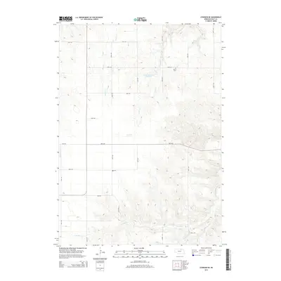
2014 Map of Atkinson NE
USGS Topo · Published 2014About this map
Phoenix Cem stands as a focal point for local history in this section of Holt County, situated near the headwaters of Turkey Cr. The landscape is defined by the dendritic drainage patterns of the Sandhills, where numerous small waterways like Spring Cr and Oak Cr carve through the prairie. In the southern portion of the quadrangle, Rock Falls marks a notable geographic feature along N Br Eagle Cr, which eventually joins with Middle Br Eagle Cr as it flows eastward. This 2014 survey illustrates the enduring rural grid system, with roads such as 887th Rd and 484th Ave providing access to remote ranch lands and the managed waters of Coleman Reservoir Number 2.
Find a feature on this map
25 named features on this map. Tap any name to fly to it.
Don’t see what you’re looking for? This feature index may not catch every label — zoom into the map to look around manually.
Map Details
Editions of this 2014 Atkinson NE Map
This is the sole edition of this map. No revisions or reprints were ever made.
Other maps of this area

1951 · Butte SW
USGS Topo · 1:24,000

1952 · Spencer South
USGS Topo · 1:24,000

1952 · Butte SE
USGS Topo · 1:24,000

1954 · Atkinson SE
USGS Topo · 1:24,000

1954 · Atkinson
USGS Topo · 1:24,000

1954 · Meek SW
USGS Topo · 1:24,000

1954 · Meek
USGS Topo · 1:24,000

1954 · Atkinson NW
USGS Topo · 1:24,000

1954 · Atkinson NE
USGS Topo · 1:24,000

1955 · O'Neill
USGS Topo · 1:250,000