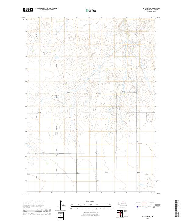
2021 Map of Atkinson NW
USGS Topo · Published 2021About this map
Sandhills terrain and agricultural section lines characterize this 2021 topographic map of north-central Nebraska. The landscape is defined by the ephemeral drainage of Brush Cr as it winds through the northern sections, while the N Br Eagle Cr marks the southeastern corner of the quadrangle. A significant point for genealogists and local historians is the Celia Cem, located centrally near the intersection of 478th Ave and 888th Rd. This small burial ground remains a primary marker of the community's early settlement history in Holt County. The rectilinear grid of county roads, such as 890 Rd and 887th Rd, underscores the enduring importance of the Public Land Survey System in organizing this rural territory.
Find a feature on this map
21 named features on this map. Tap any name to fly to it.
Don’t see what you’re looking for? This feature index may not catch every label — zoom into the map to look around manually.
Map Details
Editions of this 2021 Atkinson NW Map
This is the sole edition of this map. No revisions or reprints were ever made.
Other maps of this area

1951 · Butte SW
USGS Topo · 1:24,000

1951 · Dustin
USGS Topo · 1:24,000

1952 · Butte SE
USGS Topo · 1:24,000

1954 · Atkinson SE
USGS Topo · 1:24,000

1954 · Atkinson
USGS Topo · 1:24,000

1954 · Stuart SE
USGS Topo · 1:24,000

1954 · Atkinson NW
USGS Topo · 1:24,000

1954 · Atkinson NE
USGS Topo · 1:24,000

1954 · Stuart NE
USGS Topo · 1:24,000

1955 · O'Neill
USGS Topo · 1:250,000