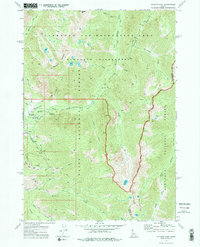
1972 Map of Atlanta East
USGS Topo · Published 1976About this map
Atlanta serves as the gateway to this high-elevation wilderness in the early 1970s, situated at the confluence of the Middle Fork Boise River and Montezuma Creek. The landscape is a study in industrial mining history transitioned into recreation, where the remnants of the Talache Mine, Monarch Mine, and Minerva Mine are interspersed with the thermal features of Chattanooga Hot Spring and Atlanta Hot Springs. Rugged topography is defined by Greylock Mountain and Blizzard Mtn, with narrow drainage basins like Quartz Gulch and Grays Creek carved into the granite. The transportation network is limited to a primitive Landing Strip, various pack trails, and jeep trails, reflecting a region still primarily accessible by foot or horse. Large portions of the terrain fall under the protection of the Sawtooth Nat Recreation Area and the Boise National Forest, highlighting the area's pivot toward conservation and seasonal use at sites like Powerplant Campground.
Find a feature on this map
42 named features on this map. Tap any name to fly to it.
Don’t see what you’re looking for? This feature index may not catch every label — zoom into the map to look around manually.
Map Details
Editions of this 1972 Atlanta East Map
2 editions found
Other maps of this area

1894 · Rocky Bar
USGS Topo · 1:125,000

1900 · Sawtooth
USGS Topo · 1:125,000

1955 · Hailey
USGS Topo · 1:250,000

1959 · Hailey
USGS Topo · 1:250,000

1962 · Hailey
USGS Topo · 1:250,000

1964 · Ross Peak
USGS Topo · 1:24,000

1964 · Cayuse Point
USGS Topo · 1:24,000
1964 · Snowyside Peak
USGS Topo · 1:24,000

1964 · Marshall Peak
USGS Topo · 1:24,000
1970 · Newman Peak
USGS Topo · 1:24,000