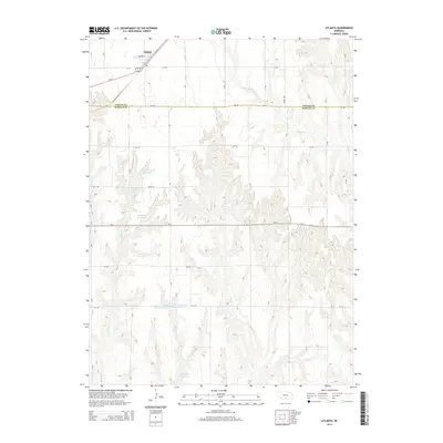
2014 Map of Atlanta
USGS Topo · Published 2014About this map
Atlanta anchors the northwest corner of this Nebraska landscape, situated along the primary corridor of Us-34 just north of the Phelps Co and Harlan Co line. The terrain transitions from the developed agricultural grid of the northern plains into the deeply dissected drainage systems of the Republican River watershed. These draws and coulees are defined by seasonal waterways such as Turkey Cr, School Cr, and Milrose Cr, which cut through the loess hills to create a complex topography of ridges and valleys.
Find a feature on this map
24 named features on this map. Tap any name to fly to it.
Don’t see what you’re looking for? This feature index may not catch every label — zoom into the map to look around manually.
Map Details
Editions of this 2014 Atlanta Map
This is the sole edition of this map. No revisions or reprints were ever made.
Other maps of this area

1896 · Holdrege
USGS Topo · 1:125,000

1896 · Arapahoe
USGS Topo · 1:125,000

1898 · Arapahoe
USGS Topo · 1:125,000

1955 · Grand Island
USGS Topo · 1:250,000

1957 · Grand Island
USGS Topo · 1:250,000

1958 · Grand Island
USGS Topo · 1:250,000

1958 · Stamford
USGS Topo · 1:24,000

1958 · Mascot
USGS Topo · 1:24,000

1970 · Holdrege East
USGS Topo · 1:24,000
1970 · Loomis
USGS Topo · 1:24,000