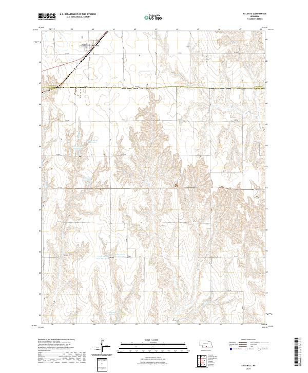
2021 Map of Atlanta
USGS Topo · Published 2021About this map
Atlanta sits at the northern edge of this Nebraska landscape, where the Burlington Northern Santa Fe railway cuts across the plains near Dunbar St. This 2021 study shows a region defined by agricultural water management, with numerous family-named reservoirs scattered across the terrain. These including the Peterson North Reservoir, Peterson South Reservoir, and McDonald Reservoir, alongside the Carter-David East Reservoir and Carter-David West Reservoir further south.
Find a feature on this map
37 named features on this map. Tap any name to fly to it.
Don’t see what you’re looking for? This feature index may not catch every label — zoom into the map to look around manually.
Map Details
Editions of this 2021 Atlanta Map
This is the sole edition of this map. No revisions or reprints were ever made.
Other maps of this area

1896 · Holdrege
USGS Topo · 1:125,000

1896 · Arapahoe
USGS Topo · 1:125,000

1898 · Arapahoe
USGS Topo · 1:125,000

1955 · Grand Island
USGS Topo · 1:250,000

1957 · Grand Island
USGS Topo · 1:250,000

1958 · Grand Island
USGS Topo · 1:250,000

1958 · Stamford
USGS Topo · 1:24,000

1958 · Mascot
USGS Topo · 1:24,000

1970 · Holdrege East
USGS Topo · 1:24,000
1970 · Loomis
USGS Topo · 1:24,000