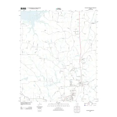
2012 Map of Atlanta North
USGS Topo · Published 2012About this map
Queen City serves as the primary hub of this 2012 survey in Cass County, where established residential streets give way to a network of rural roads and timbered corridors. The landscape is defined by the headwaters and tributaries of several prominent regional waterways, including the winding course of Black Bayou and the southeastern reaches of Wright Patman Lake. Smaller settlements and neighborhood clusters like Lanark, Hickory Hill, and Springdale are scattered across the terrain, linked by an intricate system of county roads and farm-to-market routes.
Find a feature on this map
133 named features on this map. Tap any name to fly to it.
Don’t see what you’re looking for? This feature index may not catch every label — zoom into the map to look around manually.
Map Details
Editions of this 2012 Atlanta North Map
This is the sole edition of this map. No revisions or reprints were ever made.
Other maps of this area

1907 · Atlanta
USGS Topo · 1:62,500

1909 · New Boston
USGS Topo · 1:62,500

1909 · Texarkana
USGS Topo · 1:62,500

1910 · Linden
USGS Topo · 1:62,500

1910 · Atlanta
USGS Topo · 1:62,500

1953 · Texarkana
USGS Topo · 1:250,000

1954 · Domino
USGS Topo · 1:24,000

1954 · Lake Texarkana
USGS Topo · 1:24,000
1954 · Texarkana
USGS Topo · 1:62,500

1955 · Maud
USGS Topo · 1:24,000