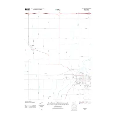
2013 Map of Atlantic
USGS Topo · Published 2013About this map
Atlantic serves as the regional hub in this 2013 landscape, where the E Nishnabotna River winds through the southwestern corner of the quadrangle. The city's grid is dense with residential streets like Chestnut St and Poplar St, anchored by the Cass County Fairground and the expansive Sunnyside Park Campground. To the northwest, the smaller settlement of Marne sits along the intersection of local routes, surrounded by a high-density network of section-line roads such as Chicago Rd and Fairview RD. The geography is defined by a series of north-south waterways, including Buck Cr and Troublesome Cr, which drain the agricultural land between the two towns. The Atlantic Municipal Airport stands as a significant landmark between the main settlement and the river valley, marking the transition from urban infrastructure to the rural township sections.
Find a feature on this map
94 named features on this map. Tap any name to fly to it.
Don’t see what you’re looking for? This feature index may not catch every label — zoom into the map to look around manually.
Map Details
Editions of this 2013 Atlantic Map
This is the sole edition of this map. No revisions or reprints were ever made.
Other maps of this area

1954 · Omaha
USGS Topo · 1:250,000

1957 · Omaha
USGS Topo · 1:250,000

1957 · Audubon
USGS Topo · 1:62,500

1958 · Omaha
USGS Topo · 1:250,000

1971 · Walnut
USGS Topo · 1:24,000

1971 · Wiota
USGS Topo · 1:24,000

1971 · Atlantic
USGS Topo · 1:24,000

1971 · Atlantic SW
USGS Topo · 1:24,000

1971 · Anita SW
USGS Topo · 1:24,000

1971 · Lewis
USGS Topo · 1:24,000