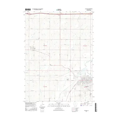
2015 Map of Atlantic
USGS Topo · Published 2015About this map
The city of Atlantic serves as a regional hub in southwestern Iowa, situated along the East Nishnabotna River and Troublesome Creek. The town grid is highly detailed, showing primary thoroughfares such as White Pole Rd and Commerce ST, alongside the Atlantic Municipal Airport to the west. This agricultural landscape is defined by the intersection of several watercourses, including Buck Cr, Spring Cr, and Camp Cr, which drain the surrounding rolling farmland. Local history is preserved at sites like Brighton Cem and Southlawn Memorial Gardens, while the small village of Marne sits near the western edge of the quadrangle. The map captures the modern connectivity of Cass County, with Interstate 80 traversing the northern border and a network of secondary routes like Marne Rd and Fairview Rd linking the rural townships.
Find a feature on this map
49 named features on this map. Tap any name to fly to it.
Don’t see what you’re looking for? This feature index may not catch every label — zoom into the map to look around manually.
Map Details
Editions of this 2015 Atlantic Map
This is the sole edition of this map. No revisions or reprints were ever made.
Other maps of this area

1954 · Omaha
USGS Topo · 1:250,000

1957 · Omaha
USGS Topo · 1:250,000

1957 · Audubon
USGS Topo · 1:62,500

1958 · Omaha
USGS Topo · 1:250,000

1971 · Walnut
USGS Topo · 1:24,000

1971 · Wiota
USGS Topo · 1:24,000

1971 · Atlantic
USGS Topo · 1:24,000

1971 · Atlantic SW
USGS Topo · 1:24,000

1971 · Anita SW
USGS Topo · 1:24,000

1971 · Lewis
USGS Topo · 1:24,000